This page will highlight changes to the landscape the consolidation process brought to the area and also show the examples of smaller holdings in existence beside the larger ones on the Earls estate.
A New Landscape
The system of farming known as Rundale was widespread in the pre-famine period along the Atlantic seaboard of Ireland. The system had its basis within co-operative farming methods, mostly within family groups. The method of subdivision of holdings of land for subsequent generations however was not sustainable, in particular in terms of population growth. The Rundale system by its nature involved entire communities. As a form of agricultural management it was flawed in terms of modernisation and output. The breakup of this system was inevitable.
Elsewhere in Ireland landlords pursued the lucrative trade in cattle at home and in England. In pursuit of this trade vast tracts of land throughout Ireland were consolidated. Mayo for the most part was precluded from this trade due to its location. By the end of the consolidation process the Earl had 60,500 acres.
Consolidation of holdings was carried out throughout Ireland . The Earl was not alone in this process. James Caird, a travel writer commenting on improvements made by the Earl are reproduced in a newspaper article from 1850, this article details the work carried out within a few miles of Newport. The writer met with the Earl who outlined that he had an extensive tract of land which he was enclosing. The style of management to be adapted was also discussed. The Earl proposed to divide the 6,000 acres he had into four farms of 1,500 acres each. As the land was hilly the plan was to drain the hollow parts which would become the arable part while the hills were to be used for grazing. He also proposed to build substantial farm steadings and enclosures. Where necessary drainage was to be carried out and all obstructions to tillage removed. The Earl proposed to offer a lease of 21 to 25 years per farm, with rent of each farm set at £600 and a guarantee the poor rate was not to exceed 1s. Per acre. A curious feature of the model farm style adapted by the Earl was the modifications made to the principal of establishing large farms. Examples of both large and small farms co existing together can be seen. This mixture of large and small in the same area clearly must have worked instead of establishing one mode over another.
This co-existence of settlements is one way of interpreting the map evidence pre and post consolidation. A clear distinction can be seen in the different field types, with the sample maps for the Ballinrobe area shown below . The smaller holdings on the periphery may have been of a lesser quality and fell outside the area suitable for tillage . Ballinrobe is a good example as the model system was followed diligently for 25 years. The field layout created at this time still exists at Ballinrobe and is a pronounced feature on the landscape in an area known as ‘The Farm’ a short distance from Cloongashel.
The following are samples of the changes to the landscape. To view further click on the images to launch map browser.
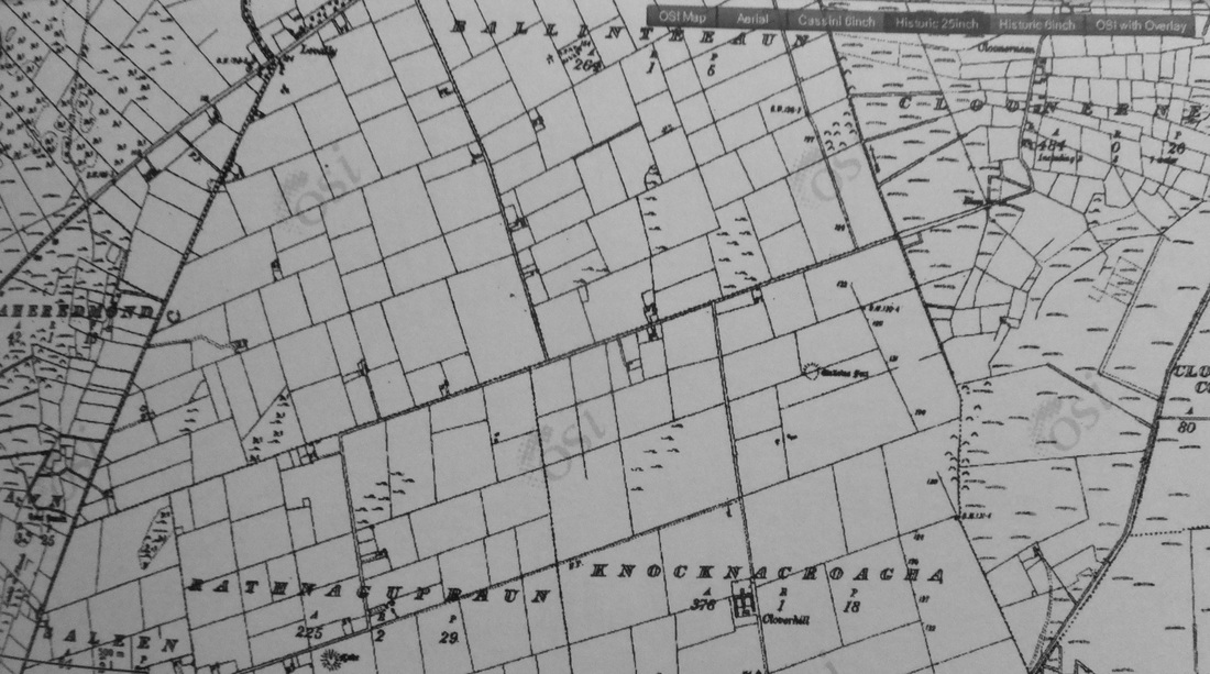
'The Farm' Ballinrobe 1894 .
The immediate landscape around the site of the farm at Castlebar has now changed due to the growth of the town; the large conspicuous regular fields noted by Forbes writing in 1853 have disappeared. Large open tracts of land owned by the Earl in the vicinity of Turlough remain. The changes to the river as discussed also remain.
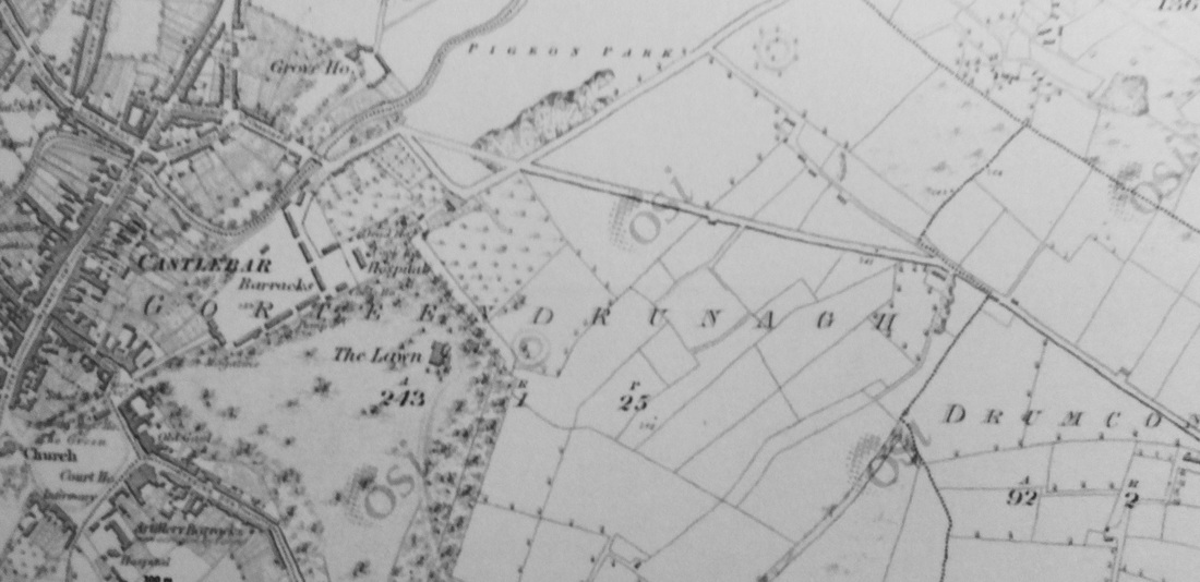
Gorteendrunagh Castlebar 1838.
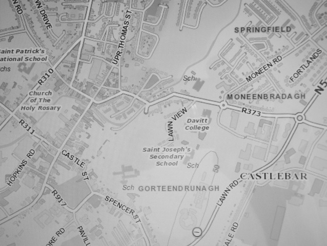
Gorteendrunagh today. Source ; Myplan.ie
Farms in
Ireland exceeding 30 Acres in 1851
Over 30 acres and not exceeding 50 acres 70,093
Over 50 acres and not exceeding 100 acres 49,940
Over 100 acres and not exceeding 200 acres 19,753
Over 200 acres and not exceeding 500 acres 7,847
Over 500 acres 1,457
Over 30 acres and not exceeding 50 acres 70,093
Over 50 acres and not exceeding 100 acres 49,940
Over 100 acres and not exceeding 200 acres 19,753
Over 200 acres and not exceeding 500 acres 7,847
Over 500 acres 1,457
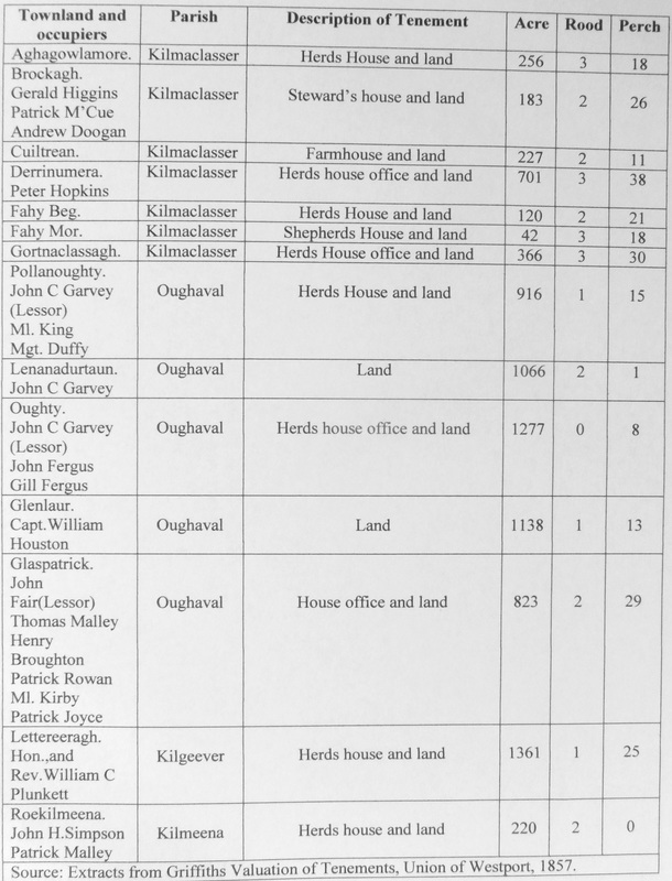
The
Earl also had interests in large farms at Lettereeragh, on Ben Gorm, Glenlaur,
and Lenadurtuaun as already noted.
Lettereeragh was the only one with a herd’s house. Given the upland nature of these farms it is
likely they were only used for grazing. James Caird points to this on his
journey from Castlebar to Westport via Newport in 1850, he describes the land
as hilly and not suitable to tillage. He
recommends grazing by ‘Hill flocks’ which may be managed profitably with turnip
farms in the Union. A method of
enclosing large areas of arable and mountain grazing pastures was ‘striping’
with a long strip of land from the bottom of the valley to the top of the
mountain. Perhaps one of the most
distinct field patterns in the district is at Roekilmeena where large strips of
land with well planted hedges are visible on the 1897 Ordinance survey map as
shown.
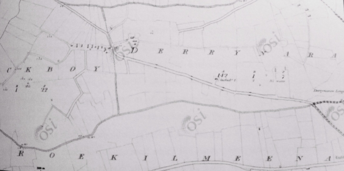
Roekilmeena 1838.
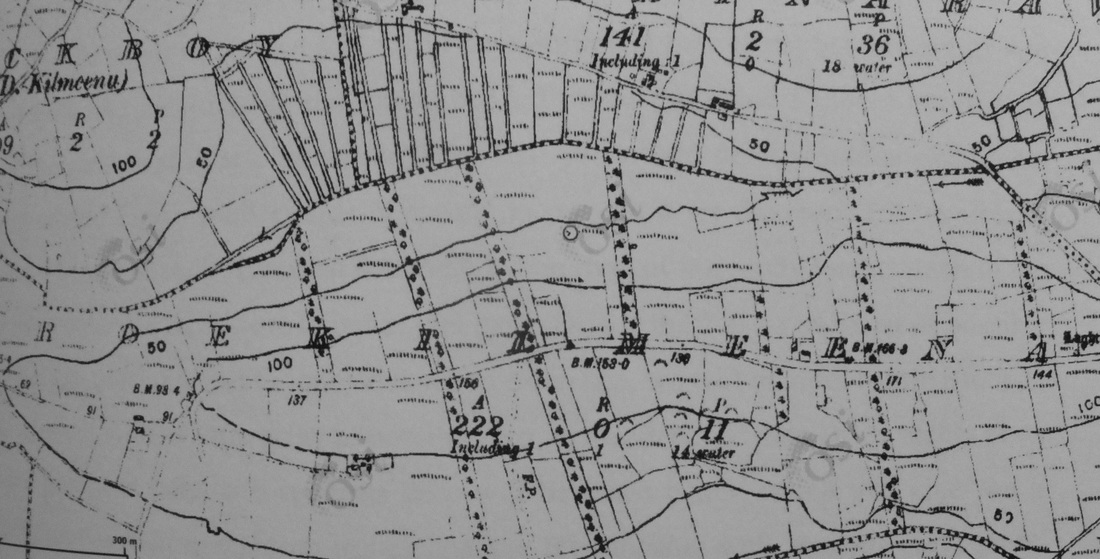
Roekilmeena 1894.
The
financial gains from these improvements were many as English attention turned
to the West of Ireland.The Mayo Constitution tells us Sir Richard A.O Donnell,
Bart., sold his Ballycroy estate in 1851 to an Englishman for £36,000. The
Landed estates database shows the estate was purchased by George Clive who
attempted to create more sustainable holdings.
The house and farm were previously owned by Thomas Birch. In the 1850s Clive along with Captain Houston
of Doolough imported Scotch blackface sheep to the area. O Donnell had previously sold a large portion
of Achill Island to Rev.Mr.Nagle. The
same newspaper account informs the reader that on Curraun, the property of a Mr
Mc Loughlin a ‘magnificent vein of copper ore was discovered’. The belief that estates should yield maximum
output was not confined to farming as this find is discussed in the article as
another ‘El Dorado’ that would scarcely need any mining to exploit it.
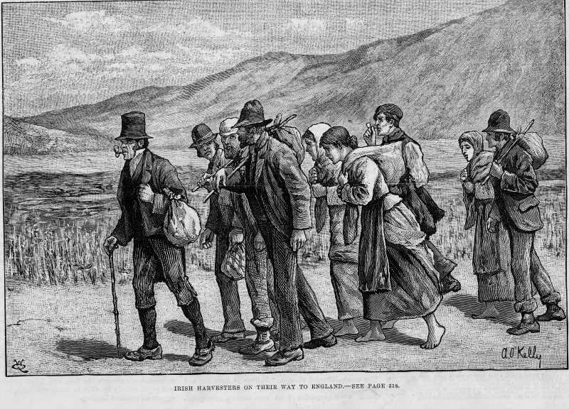
The commentator notes also the hills to the West, the property of Lord Sligo are whitening with Cheviot sheep, while cars and carts carry the dispossessed to America. It is the opinion of the commentator in the piece that the west of Ireland will soon look like an English colony with all the changes being made.
The commentator notes also the hills to the West, the property of Lord Sligo are whitening with Cheviot sheep, while cars and carts carry the dispossessed to America. It is the opinion of the commentator in the piece that the west of Ireland will soon look like an English colony with all the changes being made.
Source; Newspaper archive Mayo County Library
